How to Import Map Data into Maya (Work in Progress)
Maya has no built-in way to import real-world map data. How I am building one: OpenStreetMap buildings, terrain, roads and roofs, with renders.
If you want a real place in Maya, such as a city block, a hillside or a street for a shot, there is no built-in way to do it. Ask around and the answer is nearly always the same: use a Blender plugin, export a file, and bring it into Maya.
That works, but it is a long way round. So I am building a map importer that lives inside Maya. It is not released yet. This page is a look at where it is, with renders straight from development.
The idea
Type a place or click on a map, pick a radius, and get real geometry in your scene:
- Buildings from OpenStreetMap footprints, extruded to their real heights.
- Terrain from elevation data, so hills are hills.
- A ground map with roads, water, parks and paths painted on, or real roads as geometry.
- Roofs that are pitched or hipped where the data says so, instead of flat lids.
Everything lands in one group with the location stored on it, so the scene knows where it is in the world.
Step by step
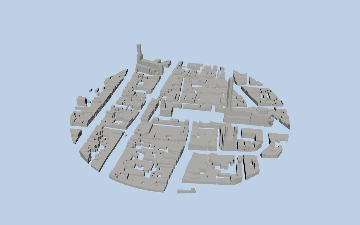
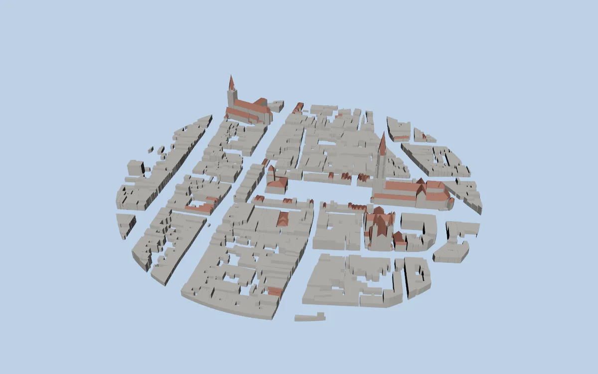
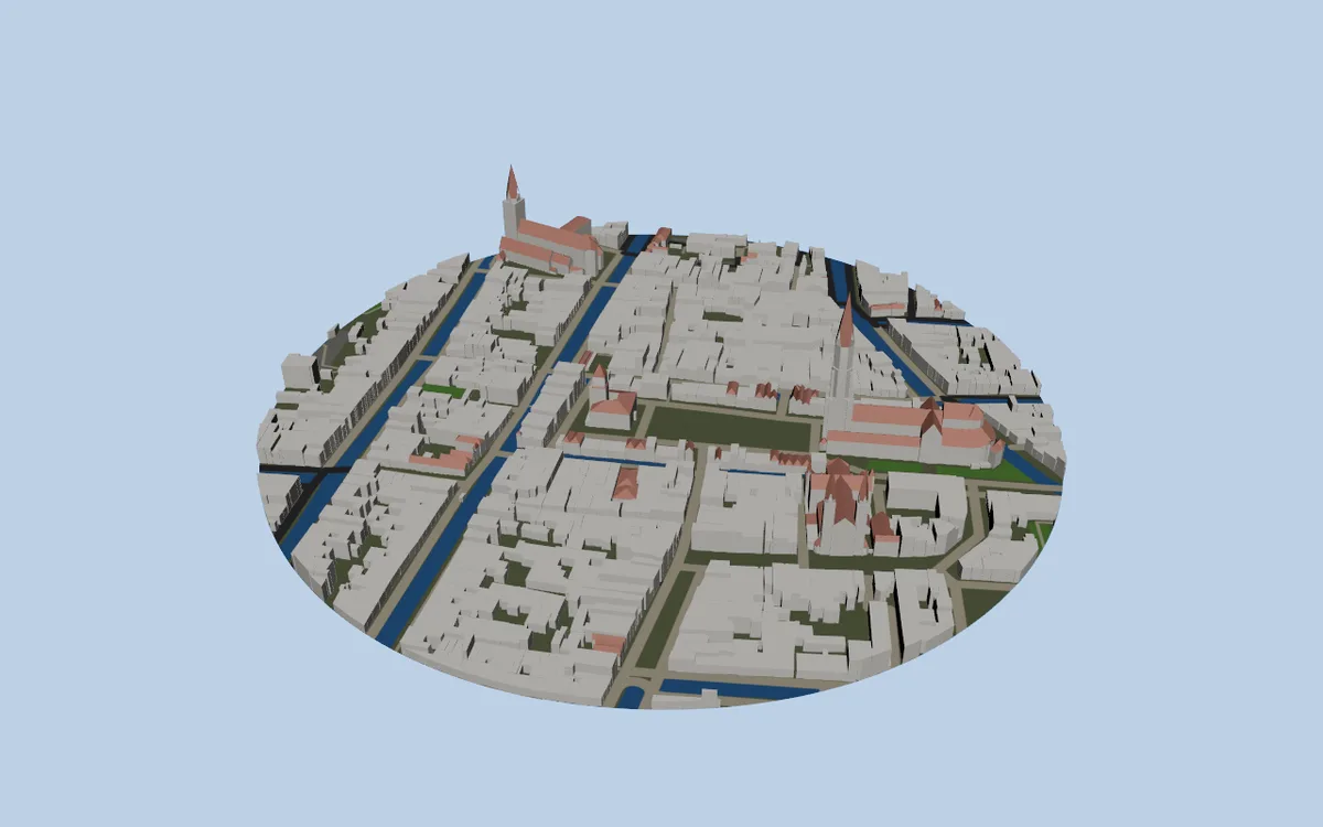
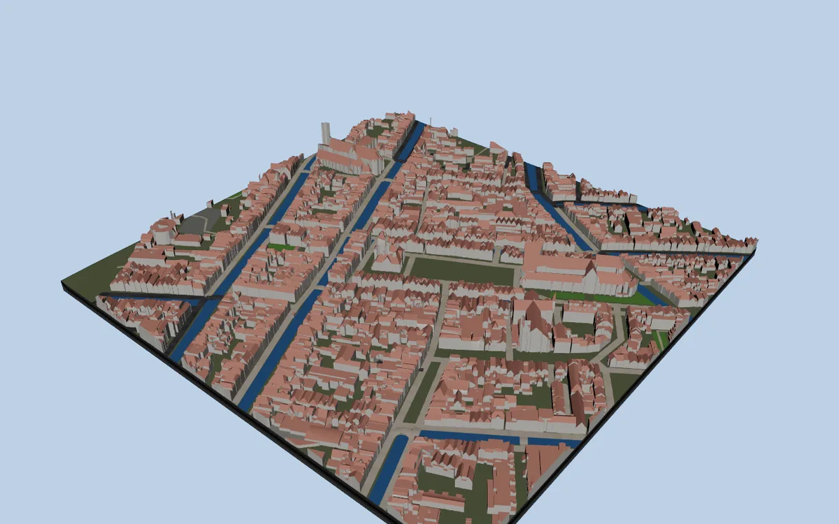
Every image below uses the same camera on the same place (Delft, in the Netherlands), with one more setting switched on each time.
Buildings
Footprints come from OpenStreetMap, and heights come from the height or floor tags. Where a building has no tag, the importer assumes a floor count. Garages and sheds get one floor, so they do not turn into towers.
Roof shapes
Where OpenStreetMap describes the roof, the importer builds it. The churches and the larger roofs stop being boxes.
Ground, water and roads
A ground map is painted from the map data: canals, roads, paths and green areas. Roads can also be built as real strips just above the terrain.
Better buildings where the data exists
Some countries publish detailed 3D building models. In the Netherlands that is the 3D BAG dataset, and I am testing it as a source. The difference is large.
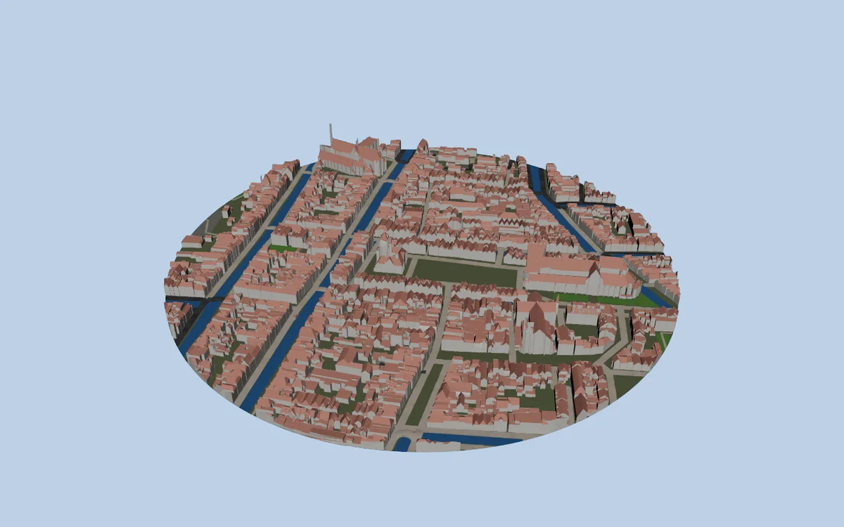
A square crop with a base gives you something that reads as a model on a plinth, which is handy for presentation shots.
Other places
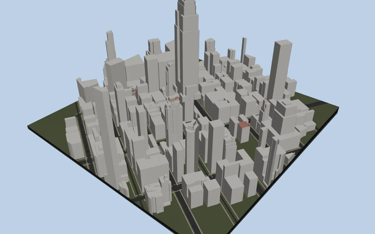
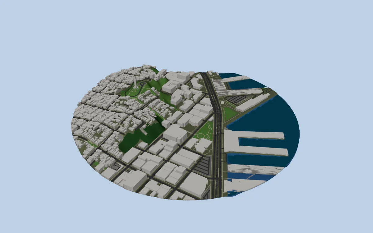
Dense cities and coastlines break things in different ways, so I keep testing on very different locations. Midtown Manhattan is mostly height, and the Embarcadero in San Francisco is mostly water.
Why not just use a Blender plugin?
Those plugins do the job, but the trip has costs:
- You export from one app and import into another, and every change means doing it again.
- Scale and orientation (Blender’s Z-up against Maya’s Y-up) have to be put right.
- Materials rarely arrive the way you expect.
Working in Maya means the result is already native geometry, in your scene units, with materials you can render.
How GLB Bridge came out of this
Some map data arrives as glTF or GLB files, and Maya’s own support for those is poor. I needed something that read them properly, with materials, textures and compression. That became GLB Bridge for Maya, a general importer and exporter for GLB and glTF. It is a separate tool you can use on its own, and the map importer uses its reader.
Where it stands
- Buildings, terrain, ground map, roads, trees and roof shapes work.
- Aerial photo textures, a sea surface and better building sources are being tested.
- Edges, bridges and heavy cities still need work.
- It is not released, there is no date, and nothing is listed yet.
I will update this page as it moves.
Data credits
Map data is © OpenStreetMap contributors, available under the Open Database License. Detailed Dutch buildings are from 3D BAG. Terrain comes from public elevation datasets.
Related tool: GLB Bridge for Maya. glTF and GLB in and out of Maya with materials already built.